
Monte Xalo topographic map
Click on the map to display elevation.
About this map
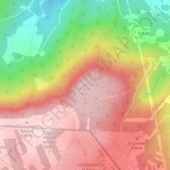
Name: Monte Xalo topographic map, elevation, terrain.
Location: Monte Xalo, Culleredo, A Coruña, Galicia, 15198, Spain (43.23241 -8.40850 43.23251 -8.40840)
Average elevation: 1,115 ft
Minimum elevation: 262 ft
Maximum elevation: 1,706 ft
Other topographic maps
Click on a map to view its topography, its elevation and its terrain.