Geolocate

Kemble topographic map

Click on the map to display elevation.

About this map

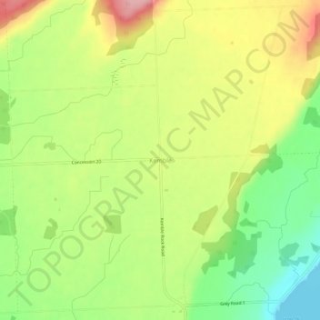
Name: Kemble topographic map, elevation, terrain.

Location: Kemble, Georgian Bluffs, Grey County, Ontario, Canada (44.70439 -80.95167 44.74439 -80.91167)

Average elevation: 797 ft

Minimum elevation: 571 ft

Maximum elevation: 1,047 ft

Gear up for your next adventure:

🎒Day Hiking Backpack - Lightweight backpack perfect for day trips and outdoor adventures
🔋Rechargeable Batteries - Power up your outdoor devices
😴Insulated Sleeping Pads - Compact and warm pads for high-elevation camping
🏔️Mountain Trail Maps - High‑detail maps for popular peaks
👖Convertible Hiking Pants - Versatile zip-off pants for changing altitudes and temperatures

As an Amazon Associate, this site earns from qualifying purchases at no extra cost to you.