Geolocate

Tom Slick Park topographic map

Click on the map to display elevation.

About this map

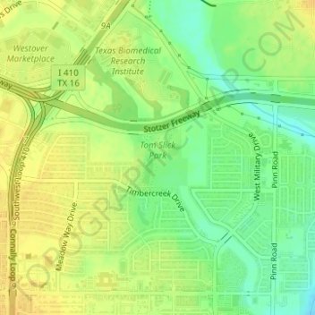
Name: Tom Slick Park topographic map, elevation, terrain.

Location: Tom Slick Park, San Antonio, Bexar County, Texas, United States (29.42651 -98.63794 29.43225 -98.63233)

Average elevation: 751 ft

Minimum elevation: 702 ft

Maximum elevation: 784 ft

Bexar County trails, hiking, mountain biking, running and outdoor activities

Other topographic maps

Click on a map to view its topography, its elevation and its terrain.

San Antonio

United States > Texas > Bexar County > San Antonio

Average elevation: 715 ft

Olmos Basin Park

United States > Texas > Bexar County > San Antonio

Average elevation: 751 ft

Gear up for your next adventure:

🎒Trail Energy Bars - High‑calorie bars for hiking energy
🧥Waterproof Jacket for Hiking - Breathable and rugged rain jacket for outdoor excursions
🥤Water Filter Bottle - All‑in‑one filter bottle for safe hydration
🔌Solar Panel Charger - Charge gear sustainably outdoors
📡Handheld GPS Device - Reliable handheld GPS for outdoor navigation

As an Amazon Associate, this site earns from qualifying purchases at no extra cost to you.