
Lake Merwin topographic map
Click on the map to display elevation.
About this map
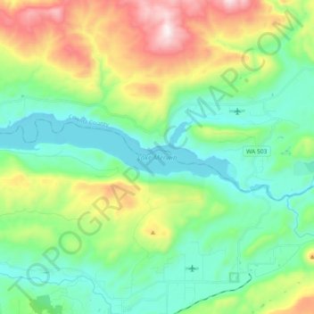
Name: Lake Merwin topographic map, elevation, terrain.
Location: Lake Merwin, Clark County, Washington, United States (45.95610 -122.56028 45.99213 -122.37901)
Average elevation: 1,060 ft
Minimum elevation: 190 ft
Maximum elevation: 3,143 ft
Clark County trails, hiking, mountain biking, running and outdoor activities
Other topographic maps
Click on a map to view its topography, its elevation and its terrain.