Geolocate

Lac Forant topographic map

Click on the map to display elevation.

About this map

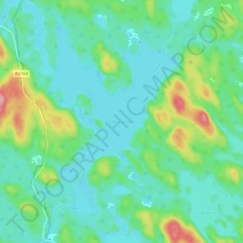
Name: Lac Forant topographic map, elevation, terrain.

Location: Lac Forant, Lac-Nilgaut, Pontiac, Outaouais, Quebec, Canada (46.37643 -77.20767 46.44139 -77.14788)

Average elevation: 935 ft

Minimum elevation: 840 ft

Maximum elevation: 1,234 ft

Other topographic maps

Click on a map to view its topography, its elevation and its terrain.

Lac Emro

Canada > Quebec > Pontiac > Lac-Nilgaut

Average elevation: 1,020 ft

Gear up for your next adventure:

🖼️Topo Map Wall Art - Decorative topographic prints of famous peaks and regions
🛏️Cold Weather Sleeping Bag - Warm sleeping bag for cold conditions
🗺️NatGeo Topo Maps - High-quality waterproof printed topographic maps of US Parks
🪶Fire Starter Kit - Reliable fire starter for survival and camping
🧭Hiking Compass - Precision compass for reliable navigation in the wilderness

As an Amazon Associate, this site earns from qualifying purchases at no extra cost to you.