Geolocate

Pleasant Valley topographic map

Click on the map to display elevation.

About this map

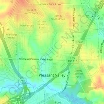
Name: Pleasant Valley topographic map, elevation, terrain.

Location: Pleasant Valley, Clay County, Missouri, United States (39.20600 -94.49316 39.23063 -94.46517)

Average elevation: 827 ft

Minimum elevation: 758 ft

Maximum elevation: 896 ft

Clay County trails, hiking, mountain biking, running and outdoor activities

Other topographic maps

Click on a map to view its topography, its elevation and its terrain.

Paradise

United States > Missouri > Clay County

Average elevation: 899 ft

Nashua

United States > Missouri > Clay County > Kansas City

Average elevation: 1,017 ft

Linden

United States > Missouri > Clay County > Gladstone

Average elevation: 965 ft

Liberty

United States > Missouri > Clay County > Liberty

Average elevation: 863 ft

Barry

United States > Missouri > Clay County > Kansas City > Barry

Average elevation: 988 ft

Smithville

United States > Missouri > Clay County > Smithville > Smithville

Average elevation: 889 ft

Gear up for your next adventure:

🪶Camp Gear Gift Set - Perfect gift bundle for outdoor fans
🪶Multi‑Purpose Knife - Useful blade for camp and trail
🪑Ultralight Camp Chairs - Portable seating for resting after a long day of mapping
🦟Ultrasonic Repellers - Create a bug-free zone at your camp or rest stop
📡Handheld GPS Device - Reliable handheld GPS for outdoor navigation

As an Amazon Associate, this site earns from qualifying purchases at no extra cost to you.