
Thank you for supporting this site ❤️
Make a donation
Make a donation
Gear up for your next adventure:
As an Amazon Associate, this site earns from qualifying purchases at no extra cost to you.
Sallen topographic map
Click on the map to display elevation.
Thank you for supporting this site ❤️
Make a donation
Make a donation
Gear up for your next adventure:
As an Amazon Associate, this site earns from qualifying purchases at no extra cost to you.
About this map
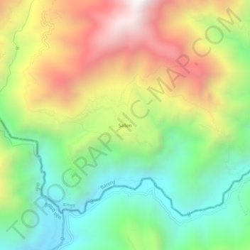
Name: Sallen topographic map, elevation, terrain.
Location: Sallen, Salyan, Bareng, Baglung, Gandaki Pradesh, Nepal (28.11951 83.41443 28.15951 83.45443)
Average elevation: 5,509 ft
Minimum elevation: 3,560 ft
Maximum elevation: 8,196 ft
Thank you for supporting this site ❤️
Make a donation
Make a donation
Gear up for your next adventure:
As an Amazon Associate, this site earns from qualifying purchases at no extra cost to you.