Geolocate

Worlds topographic map

Click on the map to display elevation.

About this map

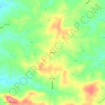
Name: Worlds topographic map, elevation, terrain.

Location: Worlds, Pittsylvania County, Virginia, United States (36.83236 -79.61086 36.87236 -79.57086)

Average elevation: 948 ft

Minimum elevation: 784 ft

Maximum elevation: 1,171 ft

Pittsylvania County trails, hiking, mountain biking, running and outdoor activities

Other topographic maps

Click on a map to view its topography, its elevation and its terrain.

Chatham

United States > Virginia > Pittsylvania County

Average elevation: 686 ft

Gear up for your next adventure:

📡Handheld GPS Device - Reliable handheld GPS for outdoor navigation
🔊Portable Camp Speaker - Music and alerts at camp
🕶️Glacier Sunglasses - Side shields to protect eyes from high-altitude snow glare
🔌USB Car Charger - Car charger for on‑the‑go power needs
🥤Water Filter Bottle - All‑in‑one filter bottle for safe hydration

As an Amazon Associate, this site earns from qualifying purchases at no extra cost to you.