
Jüterbog topographic map
Interactive map
Click on the map to display elevation.
About this map
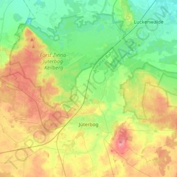
Name: Jüterbog topographic map, elevation, terrain.
Location: Jüterbog, Teltow-Fläming, Brandebourg, 14913, Allemagne (51.95493 12.95605 52.09603 13.23333)
Average elevation: 253 ft
Minimum elevation: 135 ft
Maximum elevation: 436 ft
Other topographic maps
Click on a map to view its topography, its elevation and its terrain.
Neuer Canal vom Schneide Graben zum Notten Fluss
Allemagne > Brandebourg > Teltow-Fläming > Saalow
Neuer Canal vom Schneide Graben zum Notten Fluss, Zossen, Saalow, Am Mellensee, Teltow-Fläming, Brandebourg, 15838, Allemagne
Average elevation: 128 ft
Dahme/Mark
Allemagne > Brandebourg > Teltow-Fläming
Dahme/Mark, Teltow-Fläming, Brandebourg, 15936, Allemagne
Average elevation: 344 ft