Geolocate

Osgood topographic map

Click on the map to display elevation.

About this map

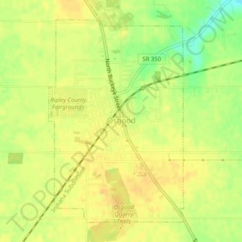
Name: Osgood topographic map, elevation, terrain.

Location: Osgood, Ripley County, Indiana, United States (39.11779 -85.30209 39.14046 -85.28245)

Average elevation: 984 ft

Minimum elevation: 915 ft

Maximum elevation: 1,014 ft

Ripley County trails, hiking, mountain biking, running and outdoor activities

Other topographic maps

Click on a map to view its topography, its elevation and its terrain.

Delaware

United States > Indiana > Ripley County

Average elevation: 971 ft

Prattsburg

United States > Indiana > Ripley County

Average elevation: 978 ft

Gear up for your next adventure:

🌡️Handheld Weather Meters - Measure wind, temp, and pressure for safe mountain travel
🦟Ultrasonic Repellers - Create a bug-free zone at your camp or rest stop
🧯Emergency Survival Kit - All‑in‑one survival essentials for the backcountry
🕶️GPS Smartphone Mount - Secure mount for phone navigation
🥄Camping Utensil Set - Lightweight utensils for outdoor meals

As an Amazon Associate, this site earns from qualifying purchases at no extra cost to you.