
Winnipegosissee topographic map
Interactive map
Click on the map to display elevation.
About this map
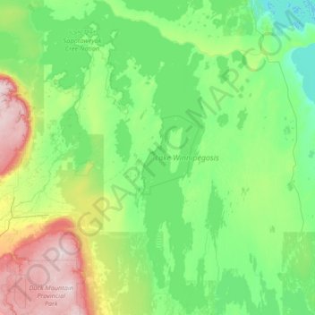
Name: Winnipegosissee topographic map, elevation, terrain.
Location: Winnipegosissee, Manitoba, Kanada (51.57234 -101.11044 53.17950 -99.62178)
Average elevation: 997 ft
Minimum elevation: 696 ft
Maximum elevation: 2,638 ft
Other topographic maps
Click on a map to view its topography, its elevation and its terrain.
Fairford River
Fairford River, Provincial Trunk Highway 6, Fairford, Manitoba, R0C 0X0, Kanada
Average elevation: 817 ft