
Hoge topographic map
Click on the map to display elevation.
About this map
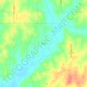
Name: Hoge topographic map, elevation, terrain.
Location: Hoge, Leavenworth County, Kansas, United States (39.15222 -95.01497 39.19222 -94.97497)
Average elevation: 906 ft
Minimum elevation: 833 ft
Maximum elevation: 1,004 ft
Leavenworth County trails, hiking, mountain biking, running and outdoor activities
Other topographic maps
Click on a map to view its topography, its elevation and its terrain.
Fort Leavenworth
United States > Kansas > Leavenworth County > Leavenworth > Leavenworth
Average elevation: 827 ft