
Madeley topographic map
Click on the map to display elevation.
About this map
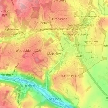
Name: Madeley topographic map, elevation, terrain.
Location: Madeley, Telford and Wrekin, England, United Kingdom (52.61783 -2.48549 52.65444 -2.41647)
Average elevation: 381 ft
Minimum elevation: 121 ft
Maximum elevation: 577 ft
Other topographic maps
Click on a map to view its topography, its elevation and its terrain.
Shropshire Union Canal Newport Branch
United Kingdom > England > Telford and Wrekin > Newport
Average elevation: 253 ft
Honnington Grange
United Kingdom > England > Telford and Wrekin > Lilleshall
Average elevation: 279 ft
Shropshire Union Canal Newport Branch
United Kingdom > England > Telford and Wrekin > Newport
Average elevation: 249 ft