
Kingsclear topographic map
Click on the map to display elevation.
About this map
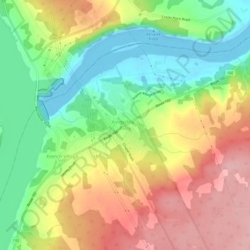
Name: Kingsclear topographic map, elevation, terrain.
Average elevation: 249 ft
Minimum elevation: -46 ft
Maximum elevation: 538 ft
Other topographic maps
Click on a map to view its topography, its elevation and its terrain.
Fredericton
Canada > New Brunswick > Kingsclear Parish > Fredericton
At an altitude of about 17 m (56 ft) above sea level, Fredericton is nestled in the Pennsylvanian Basin. It differs markedly from the geologically older parts of the province. There are prominently two distinct areas in the region that are divided around the area of Wilsey Road, in the east end of the city. In…
Average elevation: 236 ft