
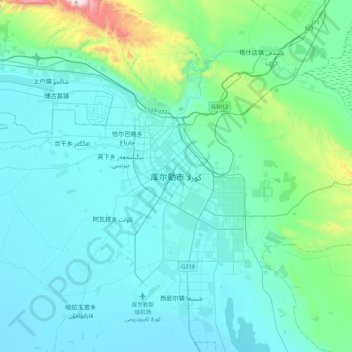
库尔勒市 topographic map
Interactive map
Click on the map to display elevation.
About this map
Name: 库尔勒市 topographic map, elevation, terrain.
Location: 库尔勒市, 巴音郭楞蒙古自治州, 新疆维吾尔自治区, 841000, 中国 (41.56387 86.01354 41.88387 86.33354)
Average elevation: 3,392 ft
Minimum elevation: 2,946 ft
Maximum elevation: 6,650 ft
Other topographic maps
Click on a map to view its topography, its elevation and its terrain.