
建设 topographic map
Interactive map
Click on the map to display elevation.
About this map
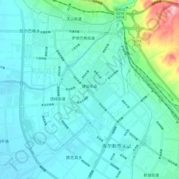
Name: 建设 topographic map, elevation, terrain.
Location: 建设, 库尔勒市, 巴音郭楞蒙古自治州, 新疆维吾尔自治区, 中国 (41.71063 86.14749 41.78199 86.24383)
Average elevation: 3,117 ft
Minimum elevation: 3,035 ft
Maximum elevation: 3,547 ft
Other topographic maps
Click on a map to view its topography, its elevation and its terrain.