Geolocate

Berlin topographic map

Click on the map to display elevation.

About this map

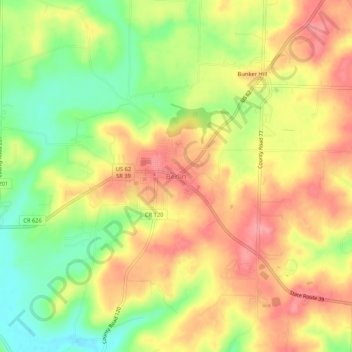
Name: Berlin topographic map, elevation, terrain.

Location: Berlin, Holmes County, Ohio, 44610, United States (40.54118 -81.81434 40.58118 -81.77434)

Average elevation: 1,171 ft

Minimum elevation: 1,001 ft

Maximum elevation: 1,306 ft

Holmes County trails, hiking, mountain biking, running and outdoor activities

Other topographic maps

Click on a map to view its topography, its elevation and its terrain.

Lake Buckhorn

United States > Ohio > Holmes County > Clark

Average elevation: 984 ft

Holmesville

United States > Ohio > Holmes County

Average elevation: 860 ft

Nashville

United States > Ohio > Holmes County

Average elevation: 1,191 ft

Gear up for your next adventure:

👓Polarized Sunglasses - Outdoor sunglasses for glare reduction
📡GPS Antenna Upgrade - Enhance GPS reception in remote terrain
🗻Climbing Gear Basics - Essential gear for beginner climbers
🥇GPS Hiking Watch - Multi‑sport GPS watch with navigation and trail tracking
🧢Outdoor Hiking Hat - Sun protection hat for outdoor explorers

As an Amazon Associate, this site earns from qualifying purchases at no extra cost to you.