
刘厂镇 topographic map
Interactive map
Click on the map to display elevation.
About this map
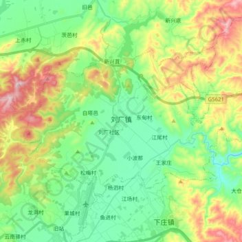
Name: 刘厂镇 topographic map, elevation, terrain.
Location: 刘厂镇, 祥云县, 大理白族自治州, 云南省, 中国 (25.44890 100.69368 25.53575 100.84871)
Average elevation: 6,693 ft
Minimum elevation: 6,201 ft
Maximum elevation: 7,664 ft
Other topographic maps
Click on a map to view its topography, its elevation and its terrain.