
Shamrock topographic map
Interactive map
Click on the map to display elevation.
About this map
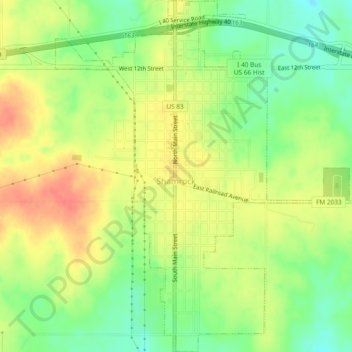
Name: Shamrock topographic map, elevation, terrain.
Location: Shamrock, Wheeler County, Texas, 79079, United States (35.19556 -100.26510 35.23387 -100.22589)
Average elevation: 2,310 ft
Minimum elevation: 2,215 ft
Maximum elevation: 2,398 ft
Other topographic maps
Click on a map to view its topography, its elevation and its terrain.
Lela
United States > Texas > Wheeler County
Lela, Wheeler County, Texas, United States
Average elevation: 2,438 ft
Twitty
United States > Texas > Wheeler County
Twitty, Wheeler County, Texas, United States
Average elevation: 2,247 ft
Wheeler
United States > Texas > Wheeler County
Wheeler, Wheeler County, Texas, 79096, United States
Average elevation: 2,523 ft