Geolocate

Mpugukye topographic map

Interactive map

Click on the map to display elevation.

About this map

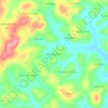
Name: Mpugukye topographic map, elevation, terrain.

Location: Mpugukye, Mubende, Central Region, Uganda (0.38741 31.17909 0.42741 31.21909)

Average elevation: 4,173 ft

Minimum elevation: 4,009 ft

Maximum elevation: 4,426 ft

Other topographic maps

Click on a map to view its topography, its elevation and its terrain.

Namungo

Uganda > Mubende

Namungo, Mubende, Central Region, Uganda

Average elevation: 4,239 ft

Nabingoola

Uganda > Mubende

Nabingoola, Mubende, Central Region, Uganda

Average elevation: 4,386 ft

Nalyankanja

Uganda > Mubende

Nalyankanja, Mubende, Central Region, Uganda

Average elevation: 4,193 ft

Rwekinena

Uganda > Mubende

Rwekinena, Mubende, Central Region, Uganda

Average elevation: 4,032 ft

Kyenda

Uganda > Mubende

Kyenda, Mubende, Central Region, Uganda

Average elevation: 4,173 ft

Kamusenene

Uganda > Mubende

Kamusenene, Mubende, Central Region, Uganda

Average elevation: 4,062 ft