
Baling topographic map
Click on the map to display elevation.
About this map
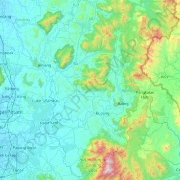
Name: Baling topographic map, elevation, terrain.
Location: Baling, Kedah, Malaysia (5.39303 100.60289 6.05088 101.12444)
Average elevation: 814 ft
Minimum elevation: 3 ft
Maximum elevation: 6,004 ft
Other topographic maps
Click on a map to view its topography, its elevation and its terrain.