Geolocate

Innisfail topographic map

Click on the map to display elevation.

About this map

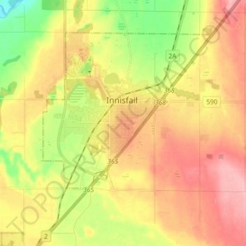
Name: Innisfail topographic map, elevation, terrain.

Location: Innisfail, Town of Innisfail, Alberta, T4G 1R1, Canada (51.98747 -113.99024 52.06747 -113.91024)

Average elevation: 3,091 ft

Minimum elevation: 2,897 ft

Maximum elevation: 3,360 ft

Gear up for your next adventure:

📡GPS Antenna Upgrade - Enhance GPS reception in remote terrain
🚁Photography Drones - Capture stunning aerial views of landforms and topography
Backpacking Tent - Lightweight and durable tent for multi‑day hikes
🏕️Tent Footprint - Protect your tent base from wear
🔋Solar Power Banks - Keep your GPS and phone charged in remote wilderness areas

As an Amazon Associate, this site earns from qualifying purchases at no extra cost to you.