
Broken Bow topographic map
Click on the map to display elevation.
Broken Bow
The city sits at the foothills of the Kiamichi Mountains, a subrange of the Ouachita Mountains. the Kiamichi Mountains sit within Le Flore, Pushmataha, and McCurtain counties near the towns of Poteau and Albion. The Kiamichi peaks line up south of the Kiamichi River and reach 2,500 feet (760 m) in elevation. The range is the namesake of Kiamichi Country, the official tourism designation for southeastern Oklahoma.
About this map
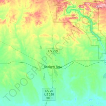
Name: Broken Bow topographic map, elevation, terrain.
Location: Broken Bow, McCurtain County, Oklahoma, United States (33.95544 -94.77445 34.15654 -94.70551)
Average elevation: 509 ft
Minimum elevation: 312 ft
Maximum elevation: 997 ft
McCurtain County trails, hiking, mountain biking, running and outdoor activities
Other topographic maps
Click on a map to view its topography, its elevation and its terrain.