
Pugalur topographic map
Click on the map to display elevation.
About this map
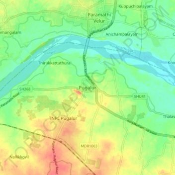
Name: Pugalur topographic map, elevation, terrain.
Location: Pugalur, Karur, Tamil Nadu, 639117, India (11.03624 77.96405 11.11624 78.04405)
Average elevation: 440 ft
Minimum elevation: 364 ft
Maximum elevation: 538 ft
Other topographic maps
Click on a map to view its topography, its elevation and its terrain.
Karur
India > Tamil Nadu > Karur
Karur is located at 10°57′36″N 78°04′30″E / 10.960°N 78.075°E / 10.960; 78.075 and has an average elevation of 101 metres or 331 feet. The town is located in Karur district, at a distance of 370 km (230 mi) from Chennai. The town is located on the banks of the rivers Amaravathi, Kaveri and…
Average elevation: 423 ft