
Heard Street topographic map
Click on the map to display elevation.
About this map
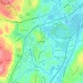
Name: Heard Street topographic map, elevation, terrain.
Average elevation: 581 ft
Minimum elevation: 456 ft
Maximum elevation: 873 ft
Other topographic maps
Click on a map to view its topography, its elevation and its terrain.
Hadwen Park
United States > Massachusetts > Worcester County > Worcester > Heard Street
Average elevation: 545 ft
Institute Park
United States > Massachusetts > Worcester County > Worcester > Belmont Hill
Average elevation: 558 ft