
Oberneukirchen topographic map
Click on the map to display elevation.
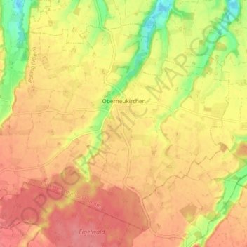
About this map
Name: Oberneukirchen topographic map, elevation, terrain.
Average elevation: 1,519 ft
Minimum elevation: 1,365 ft
Maximum elevation: 1,604 ft
Other topographic maps
Click on a map to view its topography, its elevation and its terrain.
Teising
Deutschland > Bayern > Landkreis Mühldorf am Inn > Neumarkt-Sankt Veit
Average elevation: 1,522 ft
Leoprechting
Deutschland > Bayern > Landkreis Mühldorf am Inn > Niedertaufkirchen
Average elevation: 1,529 ft
Mühldorf am Inn
Deutschland > Bayern > Landkreis Mühldorf am Inn > Mühldorf a. Inn > Mühldorf am Inn
Average elevation: 1,319 ft
Furth
Deutschland > Bayern > Landkreis Mühldorf am Inn > Oberflossing > Furth
Average elevation: 1,371 ft
Kraiburg am Inn
Deutschland > Bayern > Landkreis Mühldorf am Inn > Kraiburg
Average elevation: 1,411 ft
Zaismaier
Deutschland > Bayern > Landkreis Mühldorf am Inn > Stefanskirchen > Zaismaier
Average elevation: 1,467 ft
Heisting
Deutschland > Bayern > Landkreis Mühldorf am Inn > Kraiburg > Frauendorf
Average elevation: 1,352 ft
Asenham
Deutschland > Bayern > Landkreis Mühldorf am Inn > Oberbergkirchen
Average elevation: 1,535 ft
Gerling
Deutschland > Bayern > Landkreis Mühldorf am Inn > Oberbergkirchen
Average elevation: 1,555 ft
Oberwiesbach
Deutschland > Bayern > Landkreis Mühldorf am Inn > Neumarkt-Sankt Veit > Wiesbach
Average elevation: 1,575 ft
Sankt Erasmus
Deutschland > Bayern > Landkreis Mühldorf am Inn > Waldkraiburg
Average elevation: 1,371 ft
Forchöd
Deutschland > Bayern > Landkreis Mühldorf am Inn > Haag in Oberbayern
Average elevation: 1,667 ft
Schloss Teising
Deutschland > Bayern > Landkreis Mühldorf am Inn > Neumarkt-Sankt Veit > Teising
Average elevation: 1,512 ft
Altdorf
Deutschland > Bayern > Landkreis Mühldorf am Inn > Haag in Oberbayern
Average elevation: 1,726 ft
Ziegelsham
Deutschland > Bayern > Landkreis Mühldorf am Inn > Rattenkirchen
Average elevation: 1,453 ft
Manholding
Deutschland > Bayern > Landkreis Mühldorf am Inn > Reichertsheim
Average elevation: 1,795 ft
Manholding
Deutschland > Bayern > Landkreis Mühldorf am Inn > Oberbergkirchen
Average elevation: 1,575 ft
Schloss Guttenburg
Deutschland > Bayern > Landkreis Mühldorf am Inn > Kraiburg > Frauendorf
Average elevation: 1,401 ft