Geolocate

Karlovac topographic map

Click on the map to display elevation.

About this map

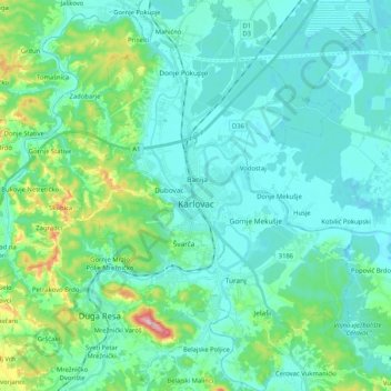
Name: Karlovac topographic map, elevation, terrain.

Location: Karlovac, Grad Karlovac, Karlovac County, Croatia (45.41990 15.48422 45.56467 15.63203)

Average elevation: 449 ft

Minimum elevation: 331 ft

Maximum elevation: 1,007 ft

Other topographic maps

Click on a map to view its topography, its elevation and its terrain.

Jelav

Croatia > Karlovac County > Grad Ogulin

Average elevation: 1,827 ft

Polje

Croatia > Karlovac County

Average elevation: 1,030 ft

Brezovac

Croatia > Karlovac County

Average elevation: 1,119 ft

Novo Selo

Croatia > Karlovac County

Average elevation: 1,047 ft

Glina

Croatia > Karlovac County

Average elevation: 561 ft

Gear up for your next adventure:

🦶Hiking Gaiters - Keep debris and water out of your boots
🌲Outdoor Survival Books - Best books on survival skills
❄️Traction Cleats - Prevent slips on icy trails during winter hikes
🪶Camp Gear Gift Set - Perfect gift bundle for outdoor fans
🦶Carbon Trekking Poles - Reduce knee impact on steep descents with ultra-light poles

As an Amazon Associate, this site earns from qualifying purchases at no extra cost to you.