Geolocate

Bayonet Point topographic map

Click on the map to display elevation.

About this map

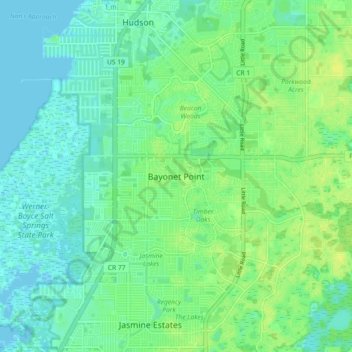
Name: Bayonet Point topographic map, elevation, terrain.

Location: Bayonet Point, Pasco County, Florida, 34668, United States (28.28667 -82.72343 28.36667 -82.64343)

Average elevation: 23 ft

Minimum elevation: -7 ft

Maximum elevation: 52 ft

Pasco County trails, hiking, mountain biking, running and outdoor activities

Other topographic maps

Click on a map to view its topography, its elevation and its terrain.

Shady Hills

United States > Florida > Pasco County

Average elevation: 59 ft

Moon Lake

United States > Florida > Pasco County > River Ridge

Average elevation: 39 ft

Odessa

United States > Florida > Pasco County

Average elevation: 56 ft

Gear up for your next adventure:

⛑️Personal Locator Beacon - Safety beacon for emergencies
🪵Folding Camp Saw - Compact saw for wood and campsite work
🏕️Family Camping Gear - Essentials for group camping trips
🥾Hiking Shoes - Durable and comfortable shoes for trail hiking
🩹Survival Bandages - High‑quality bandages for emergencies

As an Amazon Associate, this site earns from qualifying purchases at no extra cost to you.