
Readsville topographic map
Click on the map to display elevation.
About this map
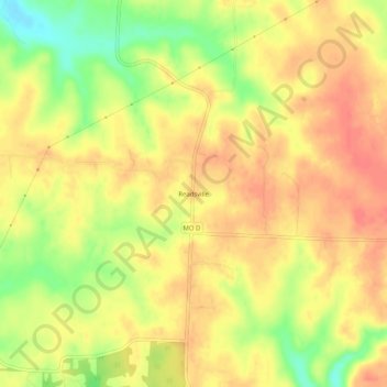
Name: Readsville topographic map, elevation, terrain.
Location: Readsville, Callaway County, Missouri, United States (38.78449 -91.73906 38.82449 -91.69906)
Average elevation: 804 ft
Minimum elevation: 689 ft
Maximum elevation: 866 ft
Callaway County trails, hiking, mountain biking, running and outdoor activities
Other topographic maps
Click on a map to view its topography, its elevation and its terrain.