
Make a donation
Gear up for your next adventure:
As an Amazon Associate, this site earns from qualifying purchases at no extra cost to you.
Wehl topographic map
Click on the map to display elevation.
Make a donation
Gear up for your next adventure:
As an Amazon Associate, this site earns from qualifying purchases at no extra cost to you.
About this map
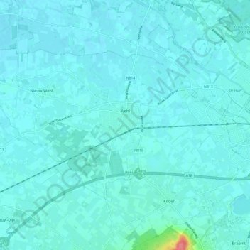
Name: Wehl topographic map, elevation, terrain.
Location: Wehl, Doetinchem, Gelderland, Nederland (51.93664 6.14469 51.98104 6.26230)
Average elevation: 46 ft
Minimum elevation: 26 ft
Maximum elevation: 259 ft
Make a donation
Gear up for your next adventure:
As an Amazon Associate, this site earns from qualifying purchases at no extra cost to you.
Other topographic maps
Click on a map to view its topography, its elevation and its terrain.
Nijmegen
Nederland > Gelderland > Nijmegen
Op 28 augustus 1979 vond in Nijmegen ter hoogte van de Muntweg een ernstig treinongeluk plaats met 8 doden en 37 gewonden. Een lege forensentrein uit Wijchen, die door een wisselstoring abusievelijk op het linkerspoor terecht was gekomen, botste frontaal op de stoptrein naar 's-Hertogenbosch. Onder de doden…
Average elevation: 52 ft
Make a donation
Gear up for your next adventure:
As an Amazon Associate, this site earns from qualifying purchases at no extra cost to you.
Make a donation
Gear up for your next adventure:
As an Amazon Associate, this site earns from qualifying purchases at no extra cost to you.
Make a donation
Gear up for your next adventure:
As an Amazon Associate, this site earns from qualifying purchases at no extra cost to you.
Make a donation
Gear up for your next adventure:
As an Amazon Associate, this site earns from qualifying purchases at no extra cost to you.
Make a donation
Gear up for your next adventure:
As an Amazon Associate, this site earns from qualifying purchases at no extra cost to you.
Make a donation
Gear up for your next adventure:
As an Amazon Associate, this site earns from qualifying purchases at no extra cost to you.
Make a donation
Gear up for your next adventure:
As an Amazon Associate, this site earns from qualifying purchases at no extra cost to you.
Achterhoek
Nederland > Gelderland > Lievelde
Wie zich een beeld probeert te vormen van het oorspronkelijke landschap, ziet een woest en moeilijk toegankelijk gebied. Het gebied bestaat uit dekzandruggen, uitlopers van een diluviaal hoogteterras van oostelijke zijde. Vele beken stromen van oost naar west en voedden een lager gelegen strook van moerasbos…
Average elevation: 177 ft
Make a donation
Gear up for your next adventure:
As an Amazon Associate, this site earns from qualifying purchases at no extra cost to you.
Make a donation
Gear up for your next adventure:
As an Amazon Associate, this site earns from qualifying purchases at no extra cost to you.