Geolocate

Kettle River topographic map

Click on the map to display elevation.

About this map

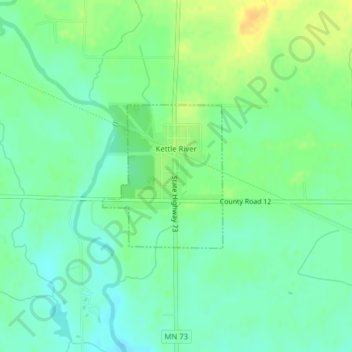
Name: Kettle River topographic map, elevation, terrain.

Location: Kettle River, Carlton County, Minnesota, United States (46.48076 -92.88553 46.49177 -92.87213)

Average elevation: 1,168 ft

Minimum elevation: 1,132 ft

Maximum elevation: 1,220 ft

Carlton County trails, hiking, mountain biking, running and outdoor activities

Other topographic maps

Click on a map to view its topography, its elevation and its terrain.

Esko

United States > Minnesota > Carlton County

Average elevation: 1,181 ft

Atkinson

United States > Minnesota > Carlton County

Average elevation: 1,158 ft

Automba

United States > Minnesota > Carlton County

Average elevation: 1,280 ft

Holyoke

United States > Minnesota > Carlton County

Average elevation: 1,024 ft

Mahtowa

United States > Minnesota > Carlton County

Average elevation: 1,168 ft

Perch Lake

United States > Minnesota > Carlton County

Average elevation: 1,309 ft

Thomson

United States > Minnesota > Carlton County > Carlton

Average elevation: 1,073 ft

Corona

United States > Minnesota > Carlton County

Average elevation: 1,299 ft

Duesler

United States > Minnesota > Carlton County

Average elevation: 1,020 ft

Harney

United States > Minnesota > Carlton County

Average elevation: 1,194 ft

Iverson

United States > Minnesota > Carlton County

Average elevation: 1,220 ft

Gear up for your next adventure:

🎒Trekking Poles - Sturdy poles for balance and stability on rough terrain
🛡️Insect Repellent - Protection against bugs during outdoor activities
☀️Outdoor Sunscreen - High protection sunscreen for outdoor activities
Camping Coffee Makers - Enjoy premium coffee at the summit or campsite
🦶Hiking Gaiters - Keep debris and water out of your boots

As an Amazon Associate, this site earns from qualifying purchases at no extra cost to you.