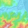
Abudaw topographic map
Click on the map to display elevation.
About this map

Name: Abudaw topographic map, elevation, terrain.
Location: Abudaw, Tala Hamza, Tichy District, Bejaia, 06120, Algeria (36.68092 5.03905 36.72092 5.07905)
Average elevation: 233 ft
Minimum elevation: -7 ft
Maximum elevation: 1,312 ft
Other topographic maps
Click on a map to view its topography, its elevation and its terrain.