
Krka National Park topographic map
Interactive map
Click on the map to display elevation.
About this map
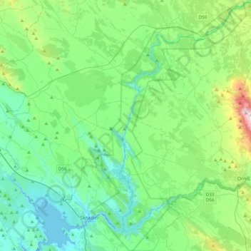
Name: Krka National Park topographic map, elevation, terrain.
Location: Krka National Park, Šibenik-Knin County, Croatia (43.78130 15.92654 44.05256 16.16014)
Average elevation: 755 ft
Minimum elevation: -16 ft
Maximum elevation: 3,596 ft
Other topographic maps
Click on a map to view its topography, its elevation and its terrain.
Vodice
Vodice, Grad Vodice, Šibenik-Knin County, 22100, Croatia
Average elevation: 187 ft
Vodice
Croatia > Šibenik-Knin County > Vodice
Vodice, Grad Vodice, Šibenik-Knin County, 22211, Croatia
Average elevation: 102 ft