Geolocate

Sherbrooke topographic map

Click on the map to display elevation.

About this map

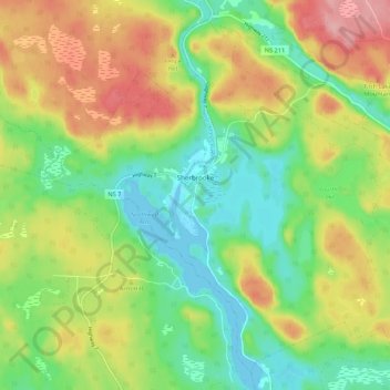
Name: Sherbrooke topographic map, elevation, terrain.

Location: Sherbrooke, St. Mary's District Municipality, Guysborough County, Nova Scotia, B0J 3C0, Canada (45.10586 -62.02222 45.17487 -61.91400)

Average elevation: 180 ft

Minimum elevation: 0 ft

Maximum elevation: 433 ft

Other topographic maps

Click on a map to view its topography, its elevation and its terrain.

Green Lake

Canada > Nova Scotia > Guysborough County > Caledonia

Average elevation: 627 ft

Gear up for your next adventure:

🪶Wildlife Field Guides - Learn animal tracking and species ID
👓Polarized Sunglasses - Outdoor sunglasses for glare reduction
🏥Hiking First Aid Kits - Comprehensive medical kits for remote trail injuries
📡GPS Antenna Upgrade - Enhance GPS reception in remote terrain
🪵Folding Camp Saw - Compact saw for wood and campsite work

As an Amazon Associate, this site earns from qualifying purchases at no extra cost to you.