Geolocate

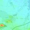
Kleinzschocher topographic map

Click on the map to display elevation.

About this map

Name: Kleinzschocher topographic map, elevation, terrain.

Location: Kleinzschocher, Südwest, Leipzig, Saxony, Germany (51.30168 12.30152 51.32097 12.34342)

Average elevation: 387 ft

Minimum elevation: 348 ft

Maximum elevation: 469 ft

Other topographic maps

Click on a map to view its topography, its elevation and its terrain.
Leipzig

Germany > Saxony > Leipzig

Average elevation: 417 ft

Tensa

Germany > Saxony > Leipzig

Average elevation: 440 ft

Gear up for your next adventure:

🌎3D Topographic Globes - Raised relief globes for a tactile understanding of geography
🧯Emergency Survival Kit - All‑in‑one survival essentials for the backcountry
🧥Men's Rain Shells - Premium waterproof and breathable jackets for mountain weather
🎒Waterproof Dry Bags - Keep your electronics and maps dry inside your pack
🥩Freeze-Dried Meals - Nutritious and lightweight food for remote expeditions

As an Amazon Associate, this site earns from qualifying purchases at no extra cost to you.