Geolocate

Hayli Gubbi topographic map

Click on the map to display elevation.

About this map

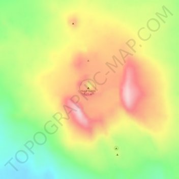
Name: Hayli Gubbi topographic map, elevation, terrain.

Location: Hayli Gubbi, Zone 2, Afar Region, Ethiopia (13.51093 40.71621 13.51103 40.71631)

Average elevation: 1,280 ft

Minimum elevation: 830 ft

Maximum elevation: 1,660 ft

Other topographic maps

Click on a map to view its topography, its elevation and its terrain.

Zone 4

Ethiopia > Afar Region

Average elevation: 2,871 ft

Danakil Depression

Ethiopia > Afar Region

Average elevation: 479 ft

Zone 3

Ethiopia > Afar Region

Average elevation: 4,035 ft

Danakil Depression

Ethiopia > Afar Region

Average elevation: -344 ft

water way

Ethiopia > Afar Region

Average elevation: 2,589 ft

Mille

Ethiopia > Afar Region > Lower Miele

Average elevation: 1,627 ft

Gear up for your next adventure:

🎒Trekking Poles - Sturdy poles for balance and stability on rough terrain
😴Insulated Sleeping Pads - Compact and warm pads for high-elevation camping
🧼Biodegradable Camping Soap - Eco‑friendly soap for outdoor hygiene
🗺️Topographic Maps - Detailed topo maps for hiking, exploring and outdoor navigation
🚗GPS Dash Cams - Record your scenic drives through mountain passes and canyons

As an Amazon Associate, this site earns from qualifying purchases at no extra cost to you.