
Edwards topographic map
Click on the map to display elevation.
About this map
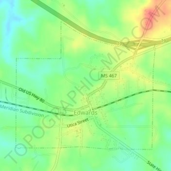
Name: Edwards topographic map, elevation, terrain.
Location: Edwards, Hinds County, Mississippi, United States (32.32427 -90.61871 32.34455 -90.59258)
Average elevation: 223 ft
Minimum elevation: 148 ft
Maximum elevation: 322 ft
Hinds County trails, hiking, mountain biking, running and outdoor activities
Other topographic maps
Click on a map to view its topography, its elevation and its terrain.