
Thank you for supporting this site ❤️
Make a donation
Make a donation
Gear up for your next adventure:
As an Amazon Associate, this site earns from qualifying purchases at no extra cost to you.
Wahoo topographic map
Click on the map to display elevation.
Thank you for supporting this site ❤️
Make a donation
Make a donation
Gear up for your next adventure:
As an Amazon Associate, this site earns from qualifying purchases at no extra cost to you.
About this map
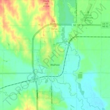
Name: Wahoo topographic map, elevation, terrain.
Location: Wahoo, Saunders County, Nebraska, 68066, United States (41.18429 -96.63776 41.24930 -96.58733)
Average elevation: 1,217 ft
Minimum elevation: 1,152 ft
Maximum elevation: 1,352 ft
Saunders County trails, hiking, mountain biking, running and outdoor activities
Thank you for supporting this site ❤️
Make a donation
Make a donation
Gear up for your next adventure:
As an Amazon Associate, this site earns from qualifying purchases at no extra cost to you.