Geolocate

Stadtlauringen topographic map

Click on the map to display elevation.

About this map

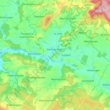
Name: Stadtlauringen topographic map, elevation, terrain.

Location: Stadtlauringen, Landkreis Schweinfurt, Bavaria, 97488, Germany (50.13362 10.31643 50.23168 10.47437)

Average elevation: 1,109 ft

Minimum elevation: 879 ft

Maximum elevation: 1,644 ft

Other topographic maps

Click on a map to view its topography, its elevation and its terrain.

Schraudenbach

Germany > Bavaria > Landkreis Schweinfurt

Average elevation: 938 ft

Gear up for your next adventure:

🦺Reflective Outdoor Gear - Safety gear for low‑light conditions
🧤Tactile Hiking Gloves - Keep hands warm while operating GPS and smartphone screens
🔥Camping Stove - Portable stove for camping and backcountry cooking
🖼️Topo Map Wall Art - Decorative topographic prints of famous peaks and regions
👖Convertible Hiking Pants - Versatile zip-off pants for changing altitudes and temperatures

As an Amazon Associate, this site earns from qualifying purchases at no extra cost to you.