
Caples Lake topographic map
Click on the map to display elevation.
About this map
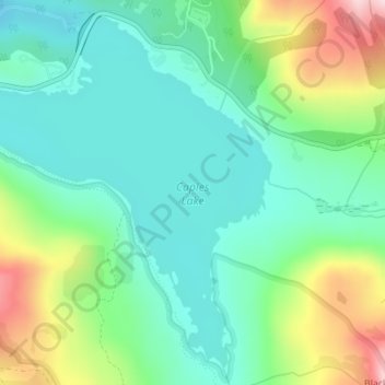
Name: Caples Lake topographic map, elevation, terrain.
Location: Caples Lake, Alpine County, California, United States (38.68383 -120.06509 38.70855 -120.03297)
Average elevation: 8,038 ft
Minimum elevation: 7,703 ft
Maximum elevation: 8,835 ft
Alpine County trails, hiking, mountain biking, running and outdoor activities
Other topographic maps
Click on a map to view its topography, its elevation and its terrain.
Bear Valley
United States > California > Alpine County
Bear Valley's central Sierra location and elevation gives it a warm-summer Mediterranean climate that is nearly a subarctic climate. Precipitation is seen for a lot of the year except for the middle of the summer, which can experience rare, but not unseen, thunderstorms. Late fall to early spring brings in…
Average elevation: 7,480 ft