
Kanacea Island topographic map
Interactive map
Click on the map to display elevation.
About this map
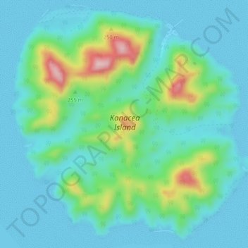
Name: Kanacea Island topographic map, elevation, terrain.
Location: Kanacea Island, Eastern, Fiji (-17.28360 -179.16999 -17.24663 -179.12989)
Average elevation: 174 ft
Minimum elevation: -16 ft
Maximum elevation: 801 ft
Other topographic maps
Click on a map to view its topography, its elevation and its terrain.