
Thank you for supporting this site ❤️
Make a donation
Make a donation
Gear up for your next adventure:
As an Amazon Associate, this site earns from qualifying purchases at no extra cost to you.
Laiya-Aplaya topographic map
Click on the map to display elevation.
Thank you for supporting this site ❤️
Make a donation
Make a donation
Gear up for your next adventure:
As an Amazon Associate, this site earns from qualifying purchases at no extra cost to you.
About this map
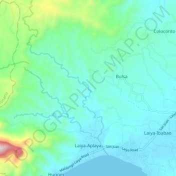
Name: Laiya-Aplaya topographic map, elevation, terrain.
Location: Laiya-Aplaya, San Juan, Batangas, Calabarzon, Philippines (13.66368 121.34580 13.73457 121.41311)
Average elevation: 381 ft
Minimum elevation: 0 ft
Maximum elevation: 2,136 ft
Thank you for supporting this site ❤️
Make a donation
Make a donation
Gear up for your next adventure:
As an Amazon Associate, this site earns from qualifying purchases at no extra cost to you.
Other topographic maps
Click on a map to view its topography, its elevation and its terrain.