
古竹村 topographic map
Interactive map
Click on the map to display elevation.
About this map
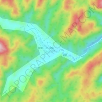
Name: 古竹村 topographic map, elevation, terrain.
Location: 古竹村, 广昌县, 抚州市, 江西省, 中国 (26.88280 116.19530 26.92280 116.23530)
Average elevation: 1,014 ft
Minimum elevation: 591 ft
Maximum elevation: 1,680 ft
Other topographic maps
Click on a map to view its topography, its elevation and its terrain.