
Sokol District topographic map
Interactive map
Click on the map to display elevation.
About this map
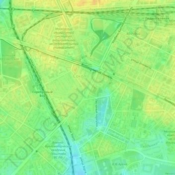
Name: Sokol District topographic map, elevation, terrain.
Location: Sokol District, Moscow, Central Federal District, Russia (55.79108 37.48686 55.81533 37.52044)
Average elevation: 531 ft
Minimum elevation: 486 ft
Maximum elevation: 568 ft
Other topographic maps
Click on a map to view its topography, its elevation and its terrain.
"Золотая миля"
"Золотая миля", Khamovniki District, Moscow, Central Federal District, 119034, Russia
Average elevation: 443 ft
Moscow Kremlin
Moscow Kremlin, Cathedral Square, Берсеневка, Moscow, Central Administrative Okrug, Moscow, Central Federal District, 103073, Russia
Average elevation: 466 ft