
Bollate topographic map
Click on the map to display elevation.
About this map
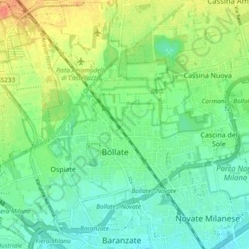
Name: Bollate topographic map, elevation, terrain.
Location: Bollate, Milan, Lombardy, 20021, Italy (45.53038 9.08234 45.56898 9.14936)
Average elevation: 522 ft
Minimum elevation: 469 ft
Maximum elevation: 607 ft
Other topographic maps
Click on a map to view its topography, its elevation and its terrain.