
Colombier topographic map
Click on the map to display elevation.
About this map
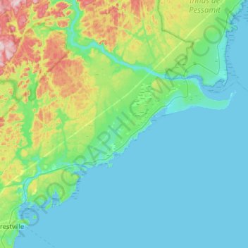
Name: Colombier topographic map, elevation, terrain.
Location: Colombier, La Haute-Côte-Nord, Côte-Nord, Quebec, Canada (48.76798 -69.12690 48.99014 -68.61357)
Average elevation: 226 ft
Minimum elevation: -3 ft
Maximum elevation: 1,312 ft