Geolocate

Elon topographic map

Click on the map to display elevation.

About this map

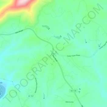
Name: Elon topographic map, elevation, terrain.

Location: Elon, Amherst County, Virginia, 24574, United States (37.49764 -79.21503 37.53764 -79.17503)

Average elevation: 843 ft

Minimum elevation: 561 ft

Maximum elevation: 1,699 ft

Amherst County trails, hiking, mountain biking, running and outdoor activities

Other topographic maps

Click on a map to view its topography, its elevation and its terrain.

Amherst

United States > Virginia > Amherst County

Average elevation: 712 ft

Gear up for your next adventure:

🥄Camping Utensil Set - Lightweight utensils for outdoor meals
🌎3D Topographic Globes - Raised relief globes for a tactile understanding of geography
🪶LED Camping Lantern - Bright lantern for camp lighting
🏔️Mountain Trail Maps - High‑detail maps for popular peaks
🪑Ultralight Camp Chairs - Portable seating for resting after a long day of mapping

As an Amazon Associate, this site earns from qualifying purchases at no extra cost to you.