
Howe Island topographic map
Click on the map to display elevation.
About this map
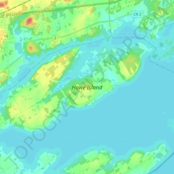
Name: Howe Island topographic map, elevation, terrain.
Average elevation: 272 ft
Minimum elevation: 236 ft
Maximum elevation: 453 ft
Other topographic maps
Click on a map to view its topography, its elevation and its terrain.
Ferguson Point
Canada > Ontario > Frontenac County > Frontenac Islands > Marysville
Average elevation: 246 ft