Geolocate

Stave Lake topographic map

Click on the map to display elevation.

About this map

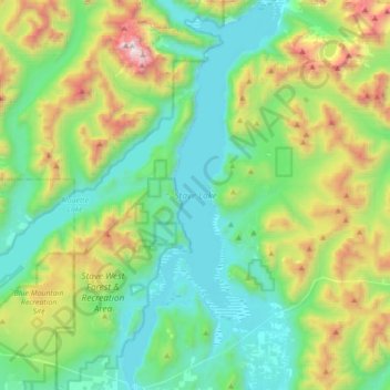
Name: Stave Lake topographic map, elevation, terrain.

Location: Stave Lake, Area F (McConnell Creek/Hatzic Prairie), British Columbia, Canada (49.22937 -122.36514 49.45823 -122.21853)

Average elevation: 1,890 ft

Minimum elevation: 190 ft

Maximum elevation: 6,739 ft

Other topographic maps

Click on a map to view its topography, its elevation and its terrain.

Gear up for your next adventure:

🪶Wildlife Field Guides - Learn animal tracking and species ID
📡Handheld GPS Device - Reliable handheld GPS for outdoor navigation
🪑Portable Camp Table - Compact table for campsite meals
🎒Trail Energy Bars - High‑calorie bars for hiking energy
🪶Compact Camp Shovel - Folding shovel for campsite tasks

As an Amazon Associate, this site earns from qualifying purchases at no extra cost to you.