Geolocate

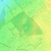
Saint-Hubert topographic map

Click on the map to display elevation.

About this map

Name: Saint-Hubert topographic map, elevation, terrain.

Location: Saint-Hubert, Longueuil, Urban agglomeration of Longueuil, Montérégie, Quebec, Canada (45.43268 -73.49025 45.55298 -73.33898)

Average elevation: 82 ft

Minimum elevation: 3 ft

Maximum elevation: 325 ft

Other topographic maps

Click on a map to view its topography, its elevation and its terrain.
Gear up for your next adventure:

🪶LED Camping Lantern - Bright lantern for camp lighting
🧯Portable Fire Pit - Compact fire pit for camping spots
🖼️Topo Map Wall Art - Decorative topographic prints of famous peaks and regions
🛡️Bear Spray Outdoor - Protection in bear country hikes
🗺️Topographic Maps - Detailed topo maps for hiking, exploring and outdoor navigation

As an Amazon Associate, this site earns from qualifying purchases at no extra cost to you.